
Moulsecoomb - Bevendean History Project

Development of the Moulsecoomb estateSouth Moulsecoomb
This map below, dated the 2nd November 1920 shows the area Brighton developed first, now known as South Moulsecoomb.
One of the conditions of the sale of the land was that the production and sale of any intoxicating liquor on any of the land was prohibited.
The Bevendean Hotel was built on land adjacent to fields originally part of Lower Bevendean Farm with an entrance from Widdicombe Way to overcome this difficulty.
Draft conveyance dated 20 November 1920 containing the condition
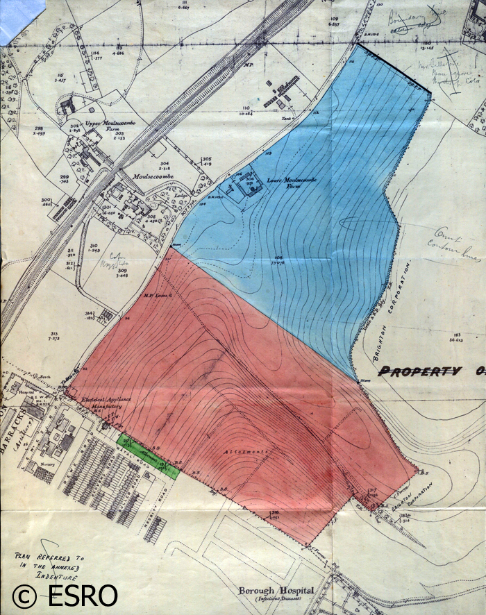
Between 1920 and 1924 the following roads were built; Baden, Canfield, Coombe (east end), Crayford, Eastbourne, Milner (east end), Natal Road (north side), Carlyle Avenue and south east end of The Avenue (to the western end of Manton Road). These roads occupy much of the pink area on the map.
The blue area also shows where the roads were built between 1920-4; the north west end of The Avenue ; The Crescent; The Highway; Colbourne & Southall Avenues; Hillside.
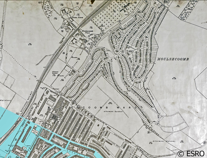
The area developed as the South Moulsecoomb Housing Estate after the First World War excluding the roads in the area highlighted turquoise, which had been developed before the First World War, shown on the map below.
The Brighton Corporation Act of 1927 gave the largest extension of the County Borough of Brighton, with effect from 1 April 1928. It included the whole of Rottingdean and Ovingdean, much of Falmer parish (that part of the Moulsecoomb estate not added in 1923, plus Bevendean and the Falmer School site), the area to the east of Dyke Road Avenue, Devil's Dyke Road in Patcham and West Blatchington. Around Seven Dials, the boundary between Brighton and Hove was straightened by transferring land on either side of Dyke Road.
The remainder of the Moulsecoomb Estate was taken within the boundaries of the Brighton Corporation during 1928.
In December 1929 a library opened in Moulsecoomb Place.
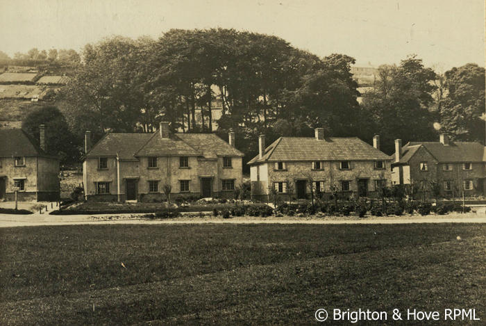
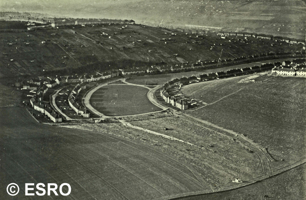
Pictures of the South Moulsecoomb Housing estate in the 1930s.
The Avenue and the start of Manton road c1930.
The Avenue seen from the air in December 1932, with Manton road on the left and the start of Higher Bevendean at the top of the slope on the right.
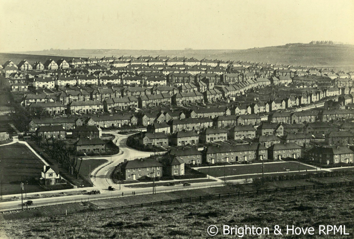
The South Moulsecoomb Housing Estate viewed from hill on the North West side of the Lewes Road.
One of the conditions of the sale of the land was that the production and sale of any intoxicating liquor on any of the land was prohibited.
The Bevendean Hotel was built on land adjacent to fields originally part of Lower Bevendean Farm with an entrance from Widdicombe Way to overcome this difficulty.
Draft conveyance dated 20 November 1920 containing the condition
Between 1920 and 1924 the following roads were built; Baden, Canfield, Coombe (east end), Crayford, Eastbourne, Milner (east end), Natal Road (north side), Carlyle Avenue and south east end of The Avenue (to the western end of Manton Road). These roads occupy much of the pink area on the map.
The blue area also shows where the roads were built between 1920-4; the north west end of The Avenue ; The Crescent; The Highway; Colbourne & Southall Avenues; Hillside.
The area developed as the South Moulsecoomb Housing Estate after the First World War excluding the roads in the area highlighted turquoise, which had been developed before the First World War, shown on the map below.
The Brighton Corporation Act of 1927 gave the largest extension of the County Borough of Brighton, with effect from 1 April 1928. It included the whole of Rottingdean and Ovingdean, much of Falmer parish (that part of the Moulsecoomb estate not added in 1923, plus Bevendean and the Falmer School site), the area to the east of Dyke Road Avenue, Devil's Dyke Road in Patcham and West Blatchington. Around Seven Dials, the boundary between Brighton and Hove was straightened by transferring land on either side of Dyke Road.
The remainder of the Moulsecoomb Estate was taken within the boundaries of the Brighton Corporation during 1928.
In December 1929 a library opened in Moulsecoomb Place.
Pictures of the South Moulsecoomb Housing estate in the 1930s.
The Avenue and the start of Manton road c1930.
The Avenue seen from the air in December 1932, with Manton road on the left and the start of Higher Bevendean at the top of the slope on the right.
The South Moulsecoomb Housing Estate viewed from hill on the North West side of the Lewes Road.
More pictures of South Moulsecoomb
