
Peoples Stories - Bevendean History Project

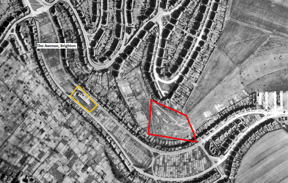
Mysterious objects at Bevendean in 1946 The aerial photograph of Bevendean taken by the RAF in 1946 shows two features not visible today.
The website received two queries about Bevendean during the war and soon after.
1.
On a 1946 aerial map of Bevendean, Brighton in the red box marked on the map there are some oblong outlines. They are clearly quite large and we hope that someone can shed some light on what they were. There are no visible marks on the hillside today.
2.
What was the building on the yellow box half way up the Avenue. There is nothing visible today. On a map from the 1940s the building is marked as the central kitchen. Can you provide any information on when it was built and when it was demolished?
Click here to see a larger image
Answers
1.
The rectangular objects in the red box shows the location of linked Anderson Air Raid Shelters for people in Bevendean Crescent and the Avenue.
2.
The white rectangle in the yellow box is a wartime emergency kitchen built to provide meals for people who had been bombed.
More information can be found in the Estate section of the website under 'Bevendean Estate during WW2'.

Story_045