
Bevendean History Project

The Lewes RoadThe
Lewes Road in Brighton is just less than 3.5 miles long and runs from
the east side of the Level to Falmer Hill which starts just beyond the
entrance to Stanmer Park. This road is now designated as the A270.
The present Lewes Road replaced the Downland Drove Road and Juggs Road which went over Newmarket Hill in medieval times from Brighton to Lewes.
The road north from the Level to the original borough boundary at Bear Road was developed from the 1860s.
The road was developed northwards into the Parish of Preston as far as
Natal Road in the 1890s and 1900s.
Allen West had a factory on the east side of the Lewes Road in the 1930s between Coombe Road and Natal Road.
The South Moulsecoomb Estate was developed in the early 1920s with North Moulsecoomb being developed between 1925 and 1929.
Moulsecoomb Place is on the east side of the road opposite the Avenue. The Bates Estate which is on the west side of the Lewes Road opposite to South Moulsecoomb was developed on the 1950s.
East Moulsecoomb which is on the opposite side of the road to the Wild Park was developed in the 1930s.
The road continues up Falmer Hill to the village of Falmer.
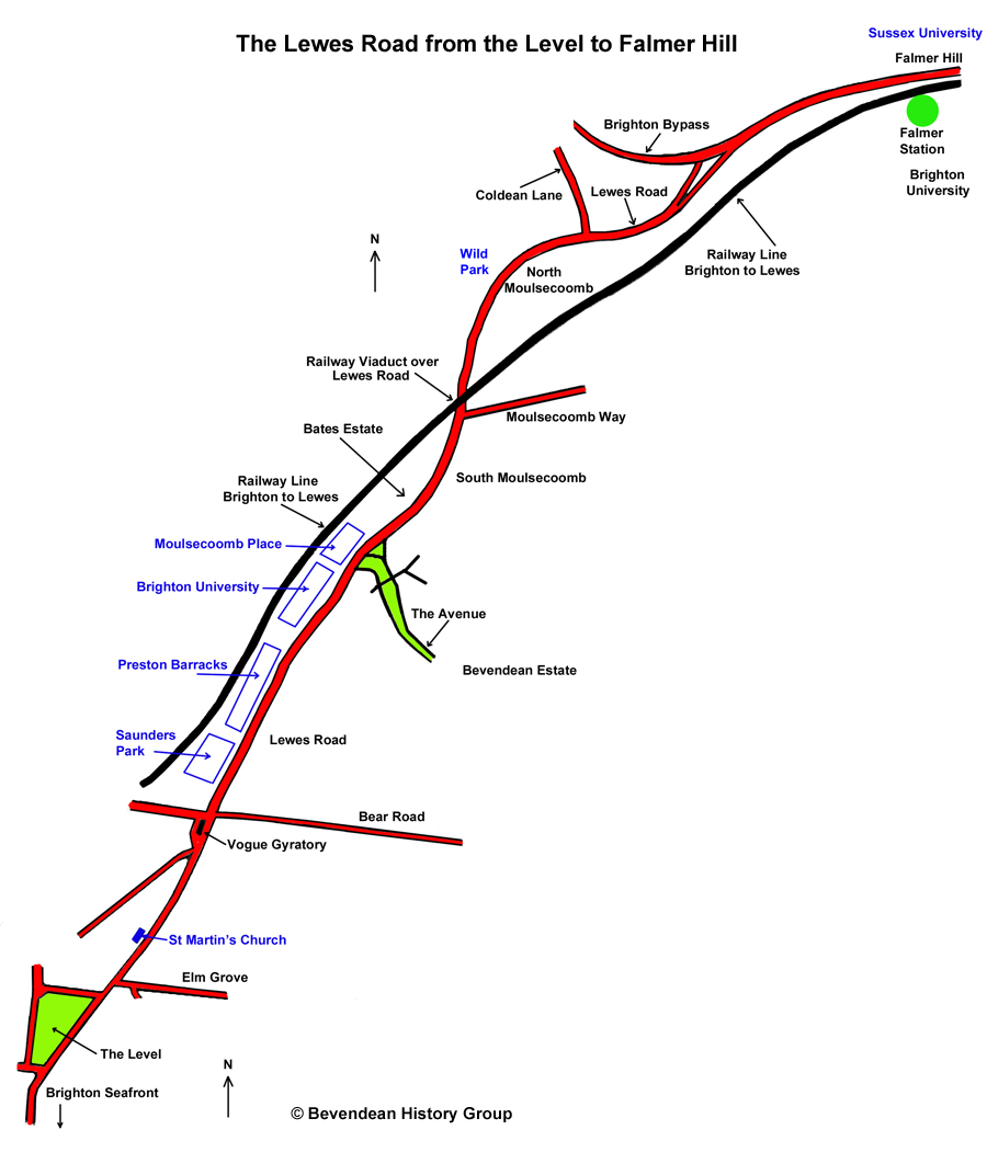
The modern road was 'dualled' to the south of The Avenue and alongside Stanmer Park in 1963-64, and the length in between was completed in 1967-68.
The dual carriageway from Brighton to Lewes was completed at Falmer in 1981, while the Brighton bypass was completion in 1995.
The bypass leaves the Lewes Road just south of the entrance to Stanmer Park and is known as the A27. The Lewes Road is now numbered as the A270.
Tree blown down at the side of the Lewes Road in Storm Eunice on 18 February 2022.
The present Lewes Road replaced the Downland Drove Road and Juggs Road which went over Newmarket Hill in medieval times from Brighton to Lewes.
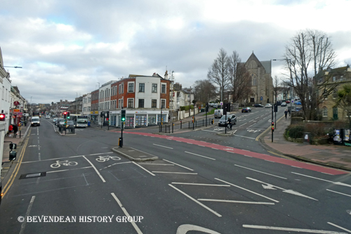 |
After the Level the Lewes Road passes the bottom of Elm Grove and got its name as it was originally lined with Elm Trees. Elm Grove leads up to the site of the Brighton General Hospital formerly the Workhouse and then onto Brighton Race Course. |
The road north from the Level to the original borough boundary at Bear Road was developed from the 1860s.
| The road passes St Martins Church which way built on the corner of Trinity Street and the Lewes Road between 1872 and 1875 and consecrated on 1 May 1875. | 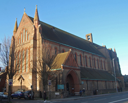 |
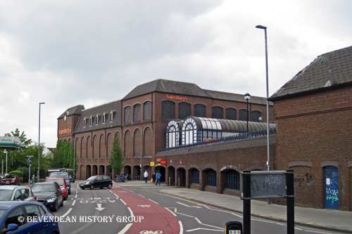 |
The
Lewes Road then went under a railway viaduct which carried a branch
line to a railway station and goods yard at Kemp Town. The viaduct was
demolished in 1976. The Cox's Pill Factory stood on part of the Sainsburys site and was demolished in the early 1980's when the Vogue Gyratory was built. |
Allen West had a factory on the east side of the Lewes Road in the 1930s between Coombe Road and Natal Road.
| Building of the Preston Barracks started in 1795 and occupied land on the west side of the Lewes Road between Saunders Park and Brighton University. When the barracks were demolished the southern end of the site was turned into a retail park and the northern end is now being developed for housing. | 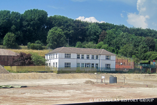 |
The South Moulsecoomb Estate was developed in the early 1920s with North Moulsecoomb being developed between 1925 and 1929.
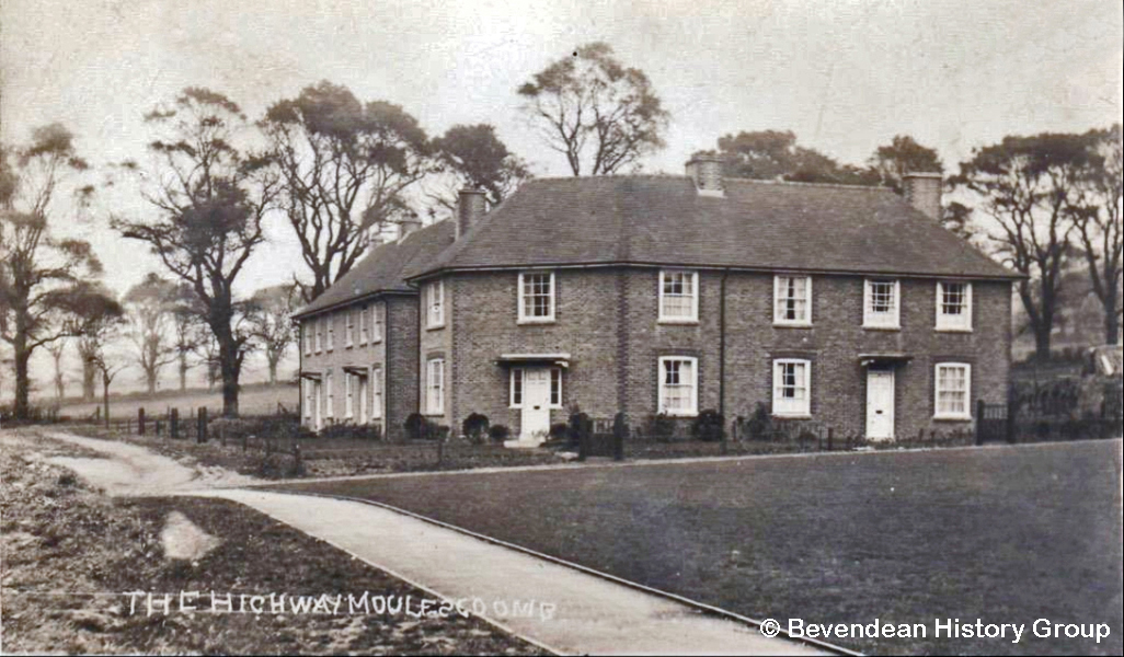 |
Council houses built in The Highway at Moulsecoomb in the 1920s. |
Moulsecoomb Place is on the east side of the road opposite the Avenue. The Bates Estate which is on the west side of the Lewes Road opposite to South Moulsecoomb was developed on the 1950s.
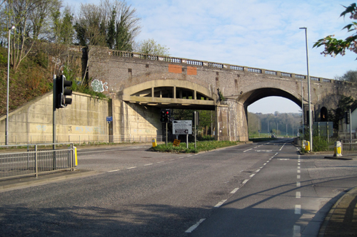 |
The Brighton to Lewes railway line crossed over the Lewes Road on a brick viaduct between Moulsecoomb Way and the Wild Park. Originally it passed under one arch in the viaduct, later the road was dualled by constructing a second carriageway under a second arch. |
| The road then passes the bottom of Coldean Lane, on the left in the picture. Coldean Lane originally formed part of the bypass round the northern edge of Brighton. |  |
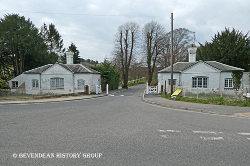 |
From Coldean Lane the road passes by Woollards Field on the right, now the site of the East Sussex Records Office, and Stanmer Park on the left. The photograph shows the Lodge Gates to Stanmer Park. |
The road continues up Falmer Hill to the village of Falmer.
The modern road was 'dualled' to the south of The Avenue and alongside Stanmer Park in 1963-64, and the length in between was completed in 1967-68.
The dual carriageway from Brighton to Lewes was completed at Falmer in 1981, while the Brighton bypass was completion in 1995.
The bypass leaves the Lewes Road just south of the entrance to Stanmer Park and is known as the A27. The Lewes Road is now numbered as the A270.
Tree blown down at the side of the Lewes Road in Storm Eunice on 18 February 2022.
Photographs of the Lewes Road from 1885 to the 1970s.
Photographs of the Lewes Road in the 21st century.
Photographs of the blossom on the trees at the side of the Lewes Road
